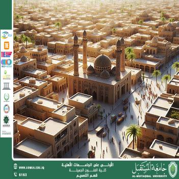

Urban Design of Al-Diwaniyah City and the History of Caravans
Al-Diwaniyah is considered one of the Iraqi cities with deep historical roots, as its early emergence and development were closely linked to trade routes and caravan movement before gradually transforming into a modern city facing contemporary urban planning challenges. Understanding the current urban condition of Al-Diwaniyah requires a historical reading of its development and an analytical connection to modern urban design concepts.
Urban design is defined as the process of organizing and shaping public spaces, buildings, and spatial relationships to achieve functional, aesthetic, and social integration within the city. It goes beyond physical land-use planning to serve as a comprehensive tool that connects people with their environment, economy, and society. Historically, Iraq was among the earliest regions to practice organized urban planning, dating back to Mesopotamian civilizations that developed structured layouts for religious, commercial, and administrative purposes.
Modern studies indicate that urban design encompasses the organization of public spaces, transportation networks, and land-use patterns in a way that enhances quality of life and social interaction. Iraqi cities have experienced several phases of urban development, ranging from traditional urban fabrics to contemporary planning attempts aimed at balancing historical identity with modern development needs, while increasingly recognizing the importance of green spaces and public areas.
Historically, Al-Diwaniyah emerged as a strategic commercial hub due to its fertile land and its location along the Euphrates River, which made it a key station for caravans and traders. By the late nineteenth century and the formation of the modern state, the city began transitioning from a seasonal market center into a stable urban settlement based on agriculture and public services. However, this transformation was not accompanied by a comprehensive urban plan, which later influenced its spatial growth.
In recent decades, Al-Diwaniyah has faced challenges similar to many Iraqi cities, including unplanned urban expansion and imbalance in land-use distribution. This has resulted in the loss of some historical characteristics, fragmentation of open spaces and public squares, and weak integration between historic urban cores and newly developed areas. Among the most pressing contemporary design issues is the lack of well-organized public spaces, as streets have become primarily transit corridors rather than social and cultural gathering places.
Another major issue is the dominance of residential land use at the expense of commercial, cultural, and recreational functions, limiting the diversity of urban activities. This reality highlights the need for a comprehensive future urban design vision that redefines Al-Diwaniyah’s identity while drawing on its historical legacy.
The future vision for urban design in Al-Diwaniyah focuses on reinterpreting historical spaces, particularly traditional markets, as cultural and economic urban attractions. It also emphasizes organizing pedestrian networks, strengthening connections between neighborhoods and public squares, and revitalizing riverfronts as dynamic urban spaces for cultural and artistic activities rooted in local heritage. Sustainable infrastructure planning and balanced land-use distribution between housing, services, education, and recreation are essential components of this vision.
In conclusion, urban design is a vital tool for understanding the evolution of cities not merely as physical spaces but as social, cultural, and historical entities. In the case of Al-Diwaniyah, linking the history of caravans and traditional markets with contemporary urban design concepts offers a valuable opportunity to plan a sustainable city that preserves its identity while adapting to future challenges.
Almustaqbal University, The First University in Iraq.
الهدف 11 – المدن و المجتمعات المستدامة